Published by admin on Tue, 01/29/2019 - 3:50pm
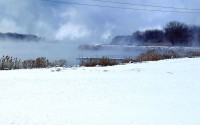
The area was braced for an uncomfortable blast of frigid air this week, set to level out as the weekend approaches. But once the cold moves out, the rain is set to settle in, which could cause areas of flooding and standing water.
The arctic blast first reared its ugly head on Tuesday morning, with the National Weather Service (NWS) reporting a local temperature of zero with a wind chill of 15 below. Those temperatures were set to be the warmest the area would see until Friday afternoon, with a wind chill warning in effect Tuesday night through Thursday afternoon.